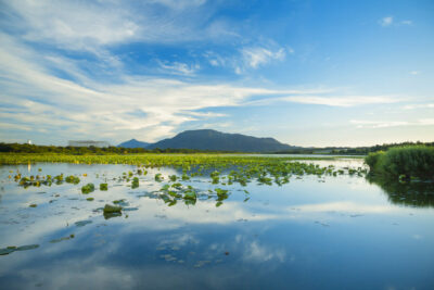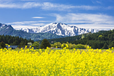
朳差岳と菜の花
2025.02.24
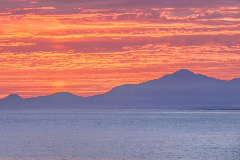
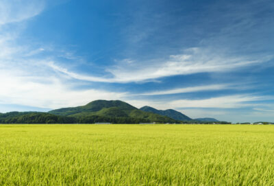
新潟県の海岸線は、地図で見ると緩やかにカーブしており、新潟市中心部から弥彦山や角田山を頭部に見立てると、大きなコウモリが翼を広げているような形に見えます。さらに、海上の佐渡島も加えると、まるで翼竜が羽を広げているかのようです。その翼竜の「手」のあたりから北東方向を望むと、海上に米山が姿を現します。
夏至の頃には、朝日が最も北寄りの位置から昇るため、海と朝日、そして米山を一つの画面に収めることができます。このため、近くのバスストップで車を停めて写真を撮る人の姿をよく見かけます。北陸自動車道の名立谷浜ICからは写真撮影スポットへ直接降りる道があり、久比岐自転車歩行者道と交差する付近に車を停めて撮影するのもおすすめです。
米山は独立峰であるため、反対側の陸地から見ても、海の上に南北対称形の美しい山容が浮かび上がるのが特徴です。「越後富士」とも呼ばれていますが、標高こそ高くはないものの、海を隔てた位置から望むその姿は印象的です。深田久弥が百名山に選ばなかったのは、ひとえに標高が足りなかったからかもしれません。しかし、他の写真でも述べたように、新潟では他にない素晴らしい個性を持った山だと感じています。
The coastline of Niigata Prefecture is gently curved when viewed on a map, and when Mt. Yahiko and Mt. Kakuda are seen as the head from the center of Niigata City, it looks like a large bat spreading its wings. If we add Sado Island on the sea, it looks like a pterosaur spreading its wings. Looking northeast from the pterosaur’s “hand,” Mt.
Around the time of the summer solstice, the sun rises at its most northerly point, allowing the sea, the sunrise, and Mt. For this reason, it is common to see people stopping their cars at nearby bus stops to take pictures. From the Nadatanihama IC of the Hokuriku Expressway, there is a direct road down to the photo spot, and it is recommended to park your car near the intersection with the Kubiki Bicycle Pedestrian Path to take pictures.
Because Mt. Yoneyama is an independent peak, its beautiful north-south symmetrical shape rises above the sea even when viewed from the opposite side of the land. It is also called “Echigo Fuji,” and although not high in elevation, the view from across the sea is impressive. The reason why Hisaya Fukada did not choose this mountain as one of the 100 most famous mountains in Japan may be due to its lack of elevation. However, as I mentioned in other photos, I feel that it is a mountain with a wonderful character not found anywhere else in Niigata.
EOS5DMarkⅢ 200mm 1/20秒 f:10
©️photo by Nakamura Osamu